
Brazil Satellite Based Earth Observation Market Size, Share, Trends and Forecast by Type, Satellite Orbit, End User, and Region, 2026-2034
Brazil Satellite Based Earth Observation Market Summary:
The Brazil satellite based earth observation market size was valued at USD 81.47 Million in 2025 and is projected to reach USD 147.78 Million by 2034, growing at a compound annual growth rate of 6.84% from 2026-2034.
The sector is experiencing sustained expansion driven by the nation's geographic complexity, vast agricultural territories spanning multiple climatic zones, and mounting environmental monitoring requirements for rainforest preservation. Advanced imaging technologies are becoming essential tools for managing the country's diverse ecosystems, optimizing natural resource extraction operations, supporting evidence-based urban and infrastructure planning. The convergence of improved satellite sensor capabilities, declining data access costs, expanding analytical software availability, and growing institutional awareness of geospatial intelligence value is expanding the Brazil satellite based earth observation market share.
Key Takeaways and Insights:
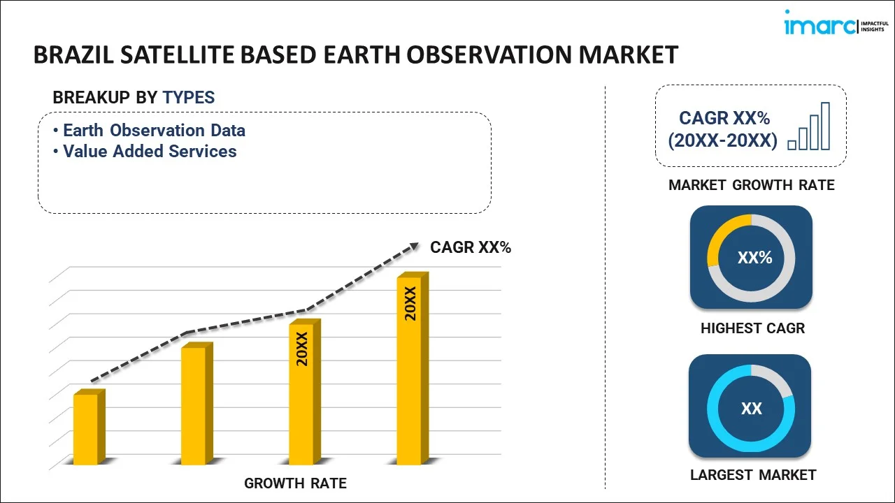
- By Type: Earth observation data dominates the market with a share of 69% in 2025, driven by raw satellite imagery demand from government agencies, research institutions, and commercial enterprises requiring unprocessed geospatial intelligence for specialized analytical workflows.
- By Satellite Orbit: Low earth orbit leads the market with a share of 64% in 2025, reflecting the superior spatial resolution capabilities and frequent revisit times that enable detailed monitoring of dynamic environmental and agricultural conditions across Brazilian territories.
- By End User: Agriculture represents the largest segment with a market share of 26% in 2025, fueled by precision farming adoption, crop health monitoring needs, and yield optimization strategies employed across Brazil's extensive farming operations.
- By Region: Southeast exhibits a clear dominance with a 42% share in 2025, attributed to the concentration of governmental space agencies, research facilities, technology companies, and agricultural enterprises in São Paulo and surrounding metropolitan areas.
- Key Players: The Brazil satellite based earth observation market exhibits a moderately consolidated competitive structure, with international satellite operators collaborating alongside domestic technology providers and regional service integrators to address diverse sectoral requirements across governmental, commercial, and research applications.
Brazil's satellite based earth observation market is fundamentally shaped by the country's position as a global agricultural powerhouse managing extensive farmlands, coupled with critical environmental stewardship responsibilities for the Amazon rainforest and other sensitive ecosystems. The Brazilian Institute of Space Research actively coordinates national satellite programs while international operators provide complementary coverage. Agricultural enterprises increasingly deploy satellite imagery for precision agriculture applications, monitoring everything from soil moisture levels to pest infestations across vast fazendas. Urban planners in rapidly expanding cities utilize earth observation data for infrastructure development, while mining companies employ satellite monitoring for environmental compliance. The convergence of improved sensor technologies, declining data access costs, and growing awareness of satellite capabilities is transforming how Brazilian institutions approach spatial intelligence across governmental, commercial, and academic domains. In 2025, the Brazilian Air Force (FAB) benefitted from low-latency satellite images for its defense and security activities via a multi-year contract signed with Telespazio Brasil, part of the Telespazio Group, and Satellogic, an expert in high-resolution Earth observation. The contract lasts for an initial period of one year, with the possibility of extending it for an additional year.
Brazil Satellite Based Earth Observation Market Trends:
Integration of Artificial Intelligence (AI) with Satellite Imagery Analysis
Brazilian organizations are increasingly incorporating artificial intelligence and machine learning algorithms into satellite image processing workflows, enabling automated feature detection, change identification, and predictive analytics that dramatically reduce manual interpretation time. Agricultural technology companies are deploying AI-powered systems that analyze multispectral satellite data to identify crop stress indicators, pest outbreaks, and irrigation deficiencies with remarkable precision. Environmental monitoring agencies utilize machine learning models trained on historical satellite imagery to predict deforestation patterns and detect illegal land clearing activities in near real-time. This technological convergence is transforming satellite data from passive observation tools into proactive decision-making systems that generate actionable intelligence. IMARC Group predicts that the Brazil artificial intelligence market is projected to attain USD 16,841.85 Million by 2033.
Expansion of Smallsat Constellations Providing Enhanced Temporal Resolution
The proliferation of small satellite constellations operated by commercial providers is fundamentally altering Brazil's earth observation landscape by delivering significantly improved revisit frequencies and near real-time monitoring capabilities. Agricultural cooperatives can now access daily or even multiple daily images of their fields, enabling responsive crop management decisions based on current conditions rather than outdated snapshots. Infrastructure monitoring agencies benefit from continuous observation of critical assets such as pipelines, transmission lines, and transportation corridors. Emergency response organizations leverage high-frequency satellite passes to track flood progression, wildfire spread, and disaster impacts with unprecedented temporal granularity, supporting more effective resource allocation during crisis situations. In 2025, The spacetech startup Grahaa Space, located in Bangalore, has received approval from the Indian National Space Promotion and Authorization Center (IN–SPACe) to carry out its first nano satellite mission, named Solaras S2, as a technology demonstration by the end of November. The launch will take place at Alcântara Space Center (CEA) in Brazil using the Hanbit-Nano launch vehicle created by Innospace, a company based in Korea.
Growing Demand for Hyperspectral Imaging Applications
Brazilian research institutions and commercial enterprises are increasingly adopting hyperspectral satellite sensors that capture hundreds of narrow spectral bands, revealing detailed material composition and environmental characteristics invisible to conventional imaging systems. Mining companies deploy hyperspectral analysis to identify mineral deposits and monitor tailings dam stability through subtle spectral signatures. Agricultural researchers utilize hyperspectral data to assess soil composition, detect plant diseases at early stages, and optimize fertilizer application based on precise nutrient deficiency mapping. Environmental agencies employ these advanced sensors to monitor water quality in reservoirs, detect oil spills, and assess vegetation health across protected areas with scientific rigor previously achievable only through ground-based sampling. In 2025, China and Brazil started constructing a collaborative laboratory for space technologies, according to Chinese state-owned defense electronics company CETC, enhancing scientific relations while both nations advance a significant telescope initiative in South America.
Market Outlook 2026-2034:
Brazil's satellite based earth observation market is positioned for substantial growth as technological advancements converge with expanding application domains and increasing recognition of spatial intelligence value across governmental and commercial sectors. The agriculture industry's continued modernization will drive sustained demand for precision farming solutions, while environmental monitoring obligations associated with international climate commitments necessitate comprehensive satellite surveillance capabilities. The market generated a revenue of USD 81.47 Million in 2025 and is projected to reach a revenue of USD 147.78 Million by 2034, growing at a compound annual growth rate of 6.84% from 2026-2034. Infrastructure development projects across Brazil's interior regions require detailed geospatial planning support, and natural resource extraction industries face mounting pressure for transparent environmental compliance documentation.
Brazil Satellite Based Earth Observation Market Report Segmentation:
| Segment Category | Leading Segment | Market Share |
|---|---|---|
| Type | Earth Observation Data | 69% |
| Satellite Orbit | Low Earth Orbit | 64% |
| End User | Agriculture | 26% |
| Region | Southeast | 42% |
Type Insights:
To get detailed segment analysis of this market Request Sample
- Earth Observation Data
- Value Added Services
Earth observation data dominates with a market share of 69% of the total Brazil satellite based earth observation market in 2025.
Earth observation data represents the foundational raw satellite imagery and sensor measurements that serve as inputs for diverse analytical workflows across governmental agencies, research institutions, and commercial enterprises. Brazilian users increasingly prefer acquiring unprocessed satellite data to maintain analytical flexibility and develop proprietary interpretation methodologies tailored to specific applications. The National Institute for Space Research distributes satellite imagery to governmental agencies and academic researchers, while commercial providers supply high-resolution optical and radar data to private sector clients. Raw data acquisition enables organizations to apply specialized processing algorithms, integrate multiple data sources, and maintain long-term archives for historical analysis and change detection studies.
The preference for earth observation data over value-added services reflects the maturation of Brazil's remote sensing expertise and the availability of sophisticated analytical software that organizations can deploy internally. Agricultural enterprises maintain in-house geospatial teams that process satellite imagery alongside field data, weather information, and agronomic knowledge to generate farm-specific insights. Mining companies employ specialized geologists who interpret multispectral and hyperspectral satellite data for exploration and environmental monitoring purposes. Environmental agencies require access to raw satellite feeds for real-time monitoring systems and compliance with data sovereignty requirements that mandate domestic processing of sensitive environmental information.
Satellite Orbit Insights:
- Low Earth Orbit
- Medium Earth Orbit
- Geostationary Orbit
Low earth orbit leads with a share of 64% of the total Brazil satellite based earth observation market in 2025.
Low earth orbit satellites operating at altitudes between six hundred and two thousand kilometers deliver the superior spatial resolution essential for detailed monitoring of agricultural operations, infrastructure assets, and environmental conditions across Brazil's diverse landscapes. The proximity to Earth's surface enables imaging systems to capture features at sub-meter resolution, revealing individual crop rows, small-scale deforestation activities, and infrastructure details invisible to higher-altitude platforms. Brazilian agricultural enterprises depend on LEO satellite imagery to monitor field-level conditions, assess crop health variations, and optimize management practices with spatial precision. The frequent orbital passes characteristic of LEO constellations provide revisit intervals measured in hours or days rather than weeks, supporting responsive decision-making for time-sensitive applications.
The dominance of low earth orbit satellites reflects their technological advantages for the applications most relevant to Brazilian users, particularly agriculture and environmental monitoring. LEO platforms equipped with synthetic aperture radar sensors penetrate cloud cover that frequently obscures optical observations in tropical regions, ensuring consistent data availability during rainy seasons. Urban development agencies utilize high-resolution LEO imagery for detailed infrastructure mapping, property assessment, and construction monitoring activities. Environmental enforcement agencies rely on frequent LEO revisits to detect illegal mining operations, unauthorized land clearing, and other activities requiring rapid identification and intervention capabilities that higher-altitude satellites cannot provide.
End User Insights:
- Urban Development and Cultural Heritage
- Agriculture
- Climate Services
- Energy and Raw Materials
- Infrastructure
- Others
Agriculture exhibits a clear dominance with a 26% share of the total Brazil satellite based earth observation market in 2025.
Agriculture represents the largest end-user segment for satellite based earth observation in Brazil, reflecting the sector's massive scale, technological sophistication, and economic importance as a primary driver of national GDP and export revenues. Brazilian agricultural enterprises manage millions of hectares across diverse climatic zones, cultivating soybeans, corn, sugarcane, coffee, and other commodities for global markets. Precision agriculture practices increasingly rely on satellite imagery to optimize input application, monitor crop development, predict yields, and respond to stress conditions before they impact productivity. Large farming operations employ agronomists and data analysts who integrate satellite observations with soil maps, weather forecasts, and machinery telemetry to implement variable rate management strategies that maximize efficiency and profitability.
The agricultural sector's leadership reflects Brazil's position as a global agricultural powerhouse facing mounting pressure to increase production while demonstrating environmental stewardship and sustainable land management practices. Satellite monitoring enables farmers to document crop rotation compliance, verify sustainable sourcing claims required by international buyers, and optimize water usage in irrigation systems. Agricultural cooperatives utilize satellite data to provide advisory services to member farmers, helping smallholders access precision agriculture benefits typically available only to large operations. Crop insurance companies increasingly incorporate satellite-based yield estimation and damage assessment into underwriting and claims processes, creating additional demand for agricultural earth observation services across Brazil's farming regions.
Regional Insights:
To get detailed regional analysis of this market Request Sample
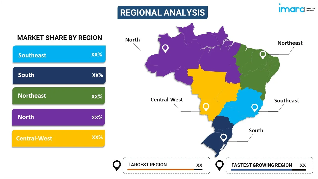
- Southeast
- South
- Northeast
- North
- Central-West
Southeast leads with a share of 42% of the total Brazil satellite based earth observation market in 2025.
The Southeast region dominates Brazil's satellite based earth observation market due to the concentration of governmental space agencies, research institutions, technology companies, and agricultural enterprises headquartered in São Paulo, Rio de Janeiro, and surrounding metropolitan areas. The Brazilian Institute of Space Research operates major facilities in São José dos Campos, coordinating national satellite programs and distributing earth observation data to governmental users nationwide. The region hosts numerous universities conducting remote sensing research, technology startups developing geospatial analytics platforms, and agricultural service providers serving Brazil's most economically developed farming areas. Corporate headquarters for major agricultural trading companies, mining enterprises, and infrastructure developers concentrate in Southeast urban centers, creating demand for satellite intelligence supporting strategic decision-making and operational monitoring.
The Southeast region's market leadership reflects its role as Brazil's economic and technological hub, where innovation, investment capital, and skilled workforce availability create favorable conditions for earth observation market development. State governments in São Paulo and Minas Gerais employ satellite monitoring for urban planning, transportation infrastructure management, and environmental compliance enforcement across densely populated metropolitan regions. The concentration of sugarcane plantations in São Paulo state drives substantial demand for satellite imagery supporting precision agriculture practices in this high-value crop sector. Technology companies developing value-added services and analytical platforms establish operations in Southeast cities to access technical talent, venture capital, and proximity to key customers across governmental and commercial sectors.
Market Dynamics:
Growth Drivers:
Why is the Brazil Satellite Based Earth Observation Market Growing?
Expansion of Precision Agriculture Adoption Across Commercial Farming Operations
Brazilian agricultural enterprises are rapidly embracing precision farming methodologies that leverage satellite imagery to optimize input application, monitor crop health, and maximize yields across vast farming operations spanning multiple properties and climatic zones. The economic imperative to reduce production costs while maintaining competitiveness in global commodity markets drives continuous innovation in farm management practices. Satellite earth observation provides the spatially explicit information necessary to implement variable rate technologies for seeds, fertilizers, pesticides, and irrigation water. Large-scale soybean and corn producers in the Central-West region utilize multispectral satellite imagery to identify within-field productivity variations, enabling targeted interventions that improve overall efficiency. The integration of satellite data with yield monitors, soil sensors, and weather forecasts creates comprehensive digital agriculture ecosystems that transform farming from intuition-based practices into data-driven operations. IMARC Group predicts that the Brazil AI in agriculture market is projected to attain USD 260.0 Million by 2034.
Intensifying Environmental Monitoring Requirements and Deforestation Prevention Initiatives
Brazil faces substantial international scrutiny and domestic pressure to demonstrate effective environmental stewardship, particularly regarding Amazon rainforest protection and compliance with climate commitments that necessitate comprehensive monitoring capabilities only achievable through satellite observation. Governmental agencies require continuous surveillance of protected areas, indigenous territories, and agricultural zones to detect illegal deforestation, unauthorized mining activities, and other environmental violations. The Brazilian Forest Code mandates that rural properties maintain specified percentages of native vegetation, creating enforcement requirements for systematic monitoring across millions of properties nationwide. International commodity buyers increasingly demand verification that agricultural products originate from deforestation-free supply chains, driving private sector investment in satellite-based traceability systems. In 2025, The UN Development Programme (UNDP) and the Ministry of Environment and Climate Change (MMA) in Brazil revealed new funding under the Floresta+ Amazon Project, featuring substantial backing from the Green Climate Fund. The program involves over R 1.5 million (approximately US$280,000) in direct compensation for environmental services to about 200 farming families in 15 municipalities in Amazonas, recognizing their contribution to preserving nearly 14,000 hectares of native forest and 8 million living trees.
Infrastructure Development Projects Requiring Detailed Geospatial Planning and Monitoring
Brazil's ambitious infrastructure modernization agenda encompasses transportation corridors, energy transmission systems, mining operations, and urban development projects that require comprehensive geospatial intelligence for planning, construction monitoring, and ongoing asset management. Transportation agencies utilize satellite imagery for highway route selection, railway corridor planning, and port expansion feasibility studies that must account for environmental constraints, land acquisition requirements, and construction logistics. Energy companies employ earth observation for transmission line routing, hydroelectric reservoir monitoring, and renewable energy site selection based on terrain characteristics and environmental considerations. Mining enterprises depend on satellite monitoring for exploration activities, tailings dam safety surveillance, and environmental compliance documentation required by regulatory agencies. The complexity and geographic scale of infrastructure projects across Brazil's vast territory make satellite observation an indispensable tool for efficient project execution and risk management. In 2024, UNCTAD teamed up with the Atlantic International Research (AIR) Centre, a non-profit entity, to assist Brazil and South Africa in enhancing their earth observation abilities.
Market Restraints:
What Challenges the Brazil Satellite Based Earth Observation Market is Facing?
Limited Technical Expertise and Analytical Capacity Among Potential End Users
Many potential beneficiaries of satellite earth observation lack the specialized technical knowledge, software tools, and analytical capabilities required to effectively process raw satellite imagery and extract actionable insights for operational decision-making. Small and medium agricultural enterprises often cannot justify employing dedicated remote sensing specialists or investing in sophisticated geospatial software platforms. Municipal governments in interior regions lack budgets for technical training and technology infrastructure necessary to incorporate satellite data into planning workflows. The learning curve associated with satellite image interpretation, the complexity of processing software, and the challenge of integrating earth observation into existing operational systems create barriers that slow market penetration beyond large organizations with established geospatial capabilities.
Cloud Cover Limitations Affecting Optical Satellite Reliability in Tropical Climates
Brazil's tropical and subtropical climate zones experience frequent cloud cover that obscures ground features during optical satellite observations, reducing data availability during critical agricultural periods and limiting reliability for time-sensitive monitoring applications. The Amazon region and coastal areas endure extended rainy seasons when persistent clouds prevent optical imaging for weeks, creating gaps in monitoring coverage precisely when environmental enforcement agencies most require surveillance capabilities. Agricultural users struggle to obtain cloud-free imagery during key crop development stages when management interventions could optimize yields. While synthetic aperture radar satellites penetrate clouds, their higher costs and more complex interpretation requirements limit accessibility for price-sensitive users. Weather-related data gaps force users to accept outdated observations or invest in more expensive radar alternatives.
High Initial Investment Costs for Satellite Data Access and Processing Infrastructure
The financial requirements for satellite data subscriptions, specialized software licenses, computing infrastructure, and technical personnel represent substantial barriers for organizations considering earth observation adoption. High-resolution commercial satellite imagery commands premium pricing that strains budgets for governmental agencies, research institutions, and agricultural cooperatives serving cost-conscious farming communities. The investment in geospatial workstations, data storage systems, and analytical software creates upfront costs that must be justified through demonstrated operational benefits. Ongoing subscription fees for satellite data access and software maintenance add recurring expenses that compete with other organizational priorities. The economic uncertainty surrounding agricultural commodity prices makes farmers reluctant to commit to multi-year satellite service contracts, limiting market growth among this critical user segment.
Competitive Landscape:
The Brazil satellite based earth observation market exhibits a moderately consolidated competitive structure characterized by international satellite operators providing primary data acquisition capabilities alongside domestic technology companies and service providers that develop localized applications and value-added solutions. Global satellite constellation operators maintain coverage of Brazilian territory through commercial agreements, while regional imagery distributors and analytics platforms address specific sector requirements. The competitive environment reflects collaboration between upstream satellite operators and downstream service providers who translate raw observation data into sector-specific intelligence products. Market participants differentiate through spatial resolution capabilities, revisit frequency, analytical methodologies, sector expertise, and integration with complementary data sources. The increasing availability of free and open satellite data from governmental space agencies creates downward pressure on commercial data pricing while simultaneously expanding the addressable market for value-added services and specialized analytical capabilities. Strategic partnerships between satellite operators, technology companies, and sector specialists enable comprehensive solution delivery across agricultural, environmental, and infrastructure applications.
Recent Developments:
- In February 2025, Atellogic Inc., a frontrunner in high-resolution Earth observation data, and Telespazio Brasil, a subsidiary of Telespazio S.p.A, which is a global leader in satellite services and a partnership between Leonardo and Thales, have established a multi-year contract with the Brazilian Air Force to deliver low-latency satellite imagery for defense and security missions within Brazil. The agreement, featuring a one-year primary duration and an option for a one-year renewal, highlights Satellogic's proficiency in providing prompt, essential insights to global defense clients.
Brazil Satellite Based Earth Observation Market Report Coverage:
| Report Features | Details |
|---|---|
| Base Year of the Analysis | 2025 |
| Historical Period | 2020-2025 |
| Forecast Period | 2026-2034 |
| Units | Million USD |
| Scope of the Report | Exploration of Historical Trends and Market Outlook, Industry Catalysts and Challenges, Segment-Wise Historical and Future Market Assessment:
|
| Types Covered | Earth Observation Data, Value Added Services |
| Satellite Orbits Covered | Low Earth Orbit, Medium Earth Orbit, Geostationary Orbit |
| End Users Covered | Urban Development and Cultural Heritage, Agriculture, Climate Services, Energy and Raw Materials, Infrastructure, Others |
| Regions Covered | Southeast, South, Northeast, North, Central-West |
| Customization Scope | 10% Free Customization |
| Post-Sale Analyst Support | 10-12 Weeks |
| Delivery Format | PDF and Excel through Email (We can also provide the editable version of the report in PPT/Word format on special request) |
Key Questions Answered in This Report
The Brazil satellite based earth observation market size was valued at USD 81.47 Million in 2025.
The Brazil satellite based earth observation market is expected to grow at a compound annual growth rate of 6.84% from 2026-2034 to reach USD 147.78 Million by 2034.
Earth observation data dominated the with a market share of 69% in 2025, driven by Brazilian organizations' preference for acquiring raw satellite imagery that provides analytical flexibility, enables proprietary processing methodologies, and supports specialized applications across governmental research and commercial sectors requiring unprocessed geospatial intelligence.
Key factors driving the Brazil satellite based earth observation market include rapid precision agriculture adoption across commercial farming operations seeking yield optimization, intensifying environmental monitoring requirements for Amazon deforestation prevention, infrastructure development projects requiring comprehensive geospatial intelligence, and advancing satellite technologies delivering improved resolution and revisit frequencies.
Major challenges include limited technical expertise and analytical capacity among potential end users restricting market penetration beyond large organizations, persistent cloud cover in tropical climates reducing optical satellite reliability during critical monitoring periods, and high initial investment costs for satellite data access and processing infrastructure creating adoption barriers for price-sensitive governmental agencies and agricultural enterprises.
Need more help?
- Speak to our experienced analysts for insights on the current market scenarios.
- Include additional segments and countries to customize the report as per your requirement.
- Gain an unparalleled competitive advantage in your domain by understanding how to utilize the report and positively impacting your operations and revenue.
- For further assistance, please connect with our analysts.
 Request Customization
 Speak to an Analyst
 Request Brochure
 Inquire Before Buying
Benefits of Customization
- Personalize this research
- Triangulate with your data
- Get data as per your format and definition
- Gain a deeper dive into a specific application, geography, customer, or competitor
- Any level of personalization
Get in Touch With Us
UNITED STATES
Phone: +1-201-971-6302
INDIA
Phone: +91-120-433-0800
UNITED KINGDOM
Phone: +44-753-714-6104
Email: sales@imarcgroup.com
Client Testimonials


.webp)


